
Pinecrest Lake NRT
check with the trail manager for updated details before visiting.
Pinecrest Lake NRT
USDA Forest Service
Urban Trail
- Length
4 miles
- Elevation Gain
--
- Route Type
out & back
(1 review)
- Length
4 miles - Elevation Gain
-- - Route Type
out & back
The trail circles Pinecrest Lake near the water's edge, providing scenic views of the lake and surrounding area.
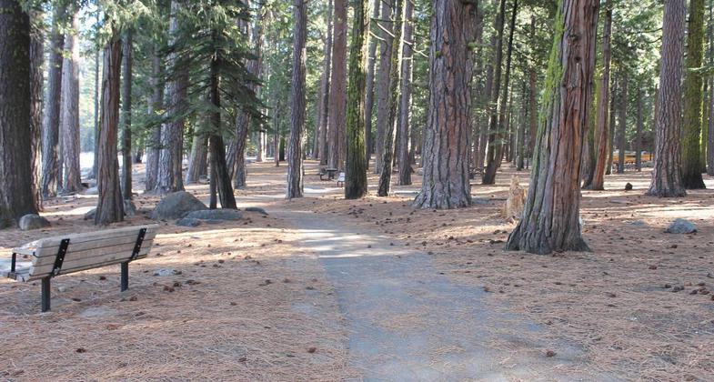
Trail and picnic area at Pinecrest Lake. Photo by Laurie Cashman.

Pinecrest National Recreation Trail
Location: Pinecrest, CA., In Stanislaus National Forest, at Pinecrest Lake 31 mi. E of Sonora on SR 108.
- States: California
- Counties: Tuolumne
This beautiful and moderately easy National Recreation Trail follows the shoreline around Pinecrest Lake, crossing the Stanislaus River, the lake's inlet, and the dam. Turn right off Highway 108 at Pinecrest Lake Road. Hike clockwise starting from the Pinecrest Lake Marina or counterclockwise starting from the south shore day-use parking area. Dogs must be on a leash (Tuolumne County Leash Law enforced).
Accessibility Information
No text provided.
Reviews

Randall Stafford
Easy Hike Around Scenic Mtn Lake
Was staying with local, while doing a PCT thru-hike, who suggested this trail as a morning jog. Great morning jog, discovered it was NRT while doing run. Beautiful view of the lake, well maintained with metal steps, concrete reinforcement, bridges and dam.
Allowed Uses:
Swimming Dogs, on leash Hiking/Walking Snow, cross-country skiing Snow, snowshoeingOther Activities
- Camping
- Fishing
- Snow, snow play general
Public Contact
Karen CaldwellStanislaus National Forest
#1 Pinecrest Lake Rd.
Pinecrest, CA 95364
[email protected] • (206) 965-3434
www.fs.usda.gov/stanislau
Contact the trail manager for current maps and visiting details.
More Details
- Elevation (low): 5619
- Elevation (high): 5719
- Elevation (cumulative): --
- Part of a Trail System? No
- Surface (primary): Soil
- Surfaces (additional): Soil
- Tread Width (average): 20"
- Tread Width (minimum): --
- Running length (minimum): --
- Tread Grade (average, percent): 7
- Tread Grade (maximum): 15
- Running length (maximum): --
- Cross-slope (average, percent): --
- Cross-slope (maximum): --
- Running length (maximum): --
- Certified as an NRT
Nov 15, 1979