Honey Creek Trail
check with the trail manager for updated details before visiting.
Honey Creek Trail
National Park Service
Backcountry Trail
- Length
5 miles
- Elevation Gain
--
- Route Type
Loop
(1 review)
- Length
5 miles - Elevation Gain
-- - Route Type
Loop
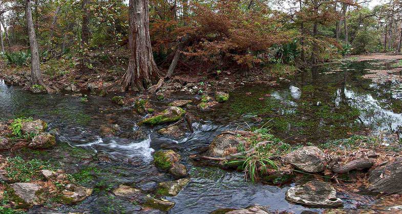
The Honey Creek Loop Trail contains some of the most rugged and beautiful terrain in Big South Fork National River and Recreation Area.


Location: Access c. 8 miles N of Elgin.
- States: Tennessee
The Honey Creek Loop Trail contains some of the most rugged and beautiful terrains in the Big South Fork National River and Recreation Area.
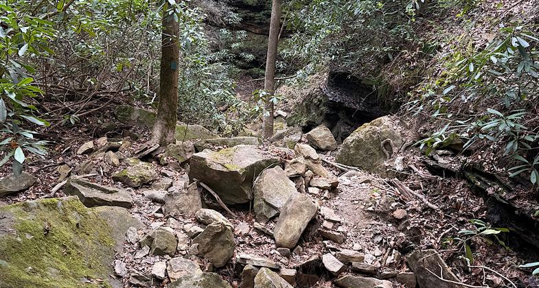
The entire loop trail system is only 5.6 miles in length, travel time is slow and the going is very difficult. Long steep stairs are located along the Honey Creek Loop Trail.
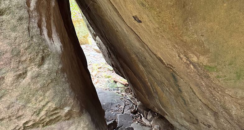
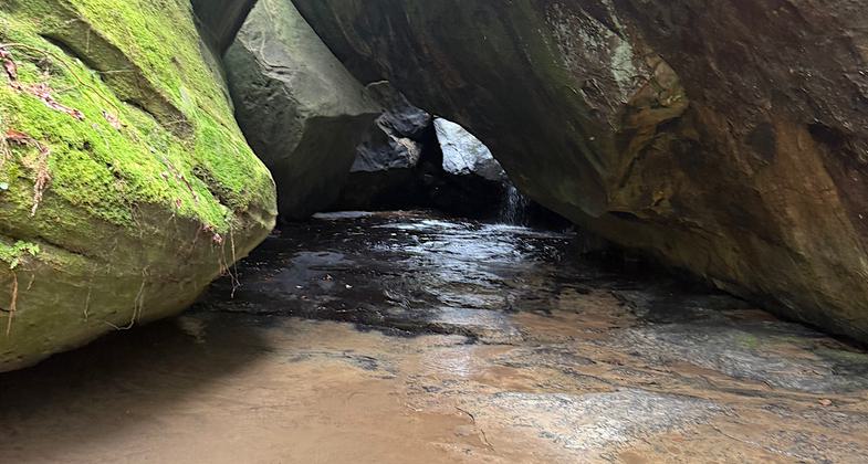
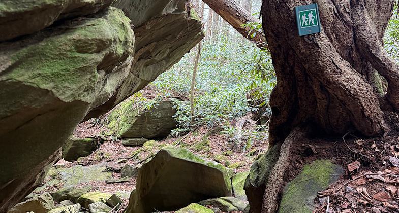
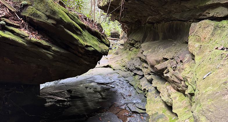
Honey Creek Loop Trail requires hikers to cross creeks and at times to travel in the creek bed itself. Traveling through boulder fields may require using your hands and knees to climb over and among boulders. Trail tread in these sections is often uneven, wet, and slippery. Extreme care should be taken when hiking in these areas. It is recommended that you do not take young children and pets on this trail. To be safe and enjoy the scenery, allow a minimum of 1 hour hiking time per mile.
Accessibility Information
No text provided.
Reviews
Patricia Ellis
Type 2 fun! Not for beginners or the faint of heart.
Hiked March 30, 2026. So much fun! Honey Creek Loop Trail is a gorgeous, remote, and rugged Type 2, 6-mile adventure with a few squeeze-through caves, steep ups and downs, and slippery creek walking. Very glad for the unusually dry conditions right now because I think one usually has to walk through ankle-to-knee-deep water in a quick-moving current, and the creek bed is mostly slick, smooth, and slanted rock. Plenty of congested vegetation with little herd paths to mistake for the trail and get lost in if one isn’t keeping a sharp eye out. This is a full-attention, try-not-to-break-a-limb kind of hike, and I loved it.
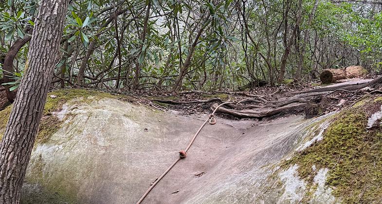
I went clockwise from the southern parking area (first one you come across as you drive toward the outlook). Note that from that parking area going clockwise, the first 2.3 miles coincide with the Sheltowee Trace Trail, and you will see signs for that trail instead of Honey Creek Loop Trail. You’re on the right trail, though. There is a sign at the point where Honey Creek Trail departs from Sheltowee Trace. Also, note that if you go clockwise, there will be a point in the trail across the stream where a rope leads steeply upward into a high cave. That is not the trail! The trail continues to the left in the stream bed itself. This is a very rugged hike and there is no cell reception - map/compass skills would come in handy if you wander too far along a herd path. The actual trail is well marked, so if you have not seen a green sign with a hiker figure on it for a while (or an orange arrow), then backtrack because you are wandering away from the trail and into the unknown.
Allowed Uses:
Hiking/WalkingPublic Contact
Bowaters Southern Paper CompanyCalhoun, TN 37309
Contact the trail manager for current maps and visiting details.
More Details
- Elevation (low): --
- Elevation (high): --
- Elevation (cumulative): --
- Part of a Trail System? No
- Surface (primary): --
- Surfaces (additional): --
- Tread Width (average): 0"
- Tread Width (minimum): --
- Running length (minimum): --
- Tread Grade (average, percent): --
- Tread Grade (maximum):
- Running length (maximum): --
- Cross-slope (average, percent): --
- Cross-slope (maximum): --
- Running length (maximum): --
- Certified as an NRT
May 31, 1973