Glacier Gorge Loop Trail
check with the trail manager for updated details before visiting.
Glacier Gorge Loop Trail
National Park Service
Backcountry Trail
Frontcountry Trail
- Length
5.8 miles
- Elevation Gain
1100
- Route Type
Loop
- Length
5.8 miles - Elevation Gain
1100 - Route Type
Loop
A high-elevation loop trail in Rocky Mountain National Park that highlights dramatic alpine scenery and pristine subalpine lakes. Popular for hiking, snowshoeing, and wildlife viewing.
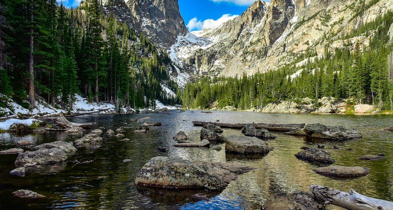


Location: Begins at Glacier Gorge Trailhead or Bear Lake Trailhead, connects Alberta Falls, Lake Haiyaha, Dream Lake, and Nymph Lake.
- States: Colorado
- Counties: Larimer
- Cities/Townships: Estes Park is nearby gateway community, but trail does not cross any cities/townships
The Glacier Gorge Loop is one of Rocky Mountain National Park’s most iconic trail systems. Starting from either the Glacier Gorge or Bear Lake Trailheads in the Bear Lake Corridor, this loop guides users through a series of spectacular alpine environments. Key destinations along the route include the cascading Alberta Falls, the crystal-clear waters of Lake Haiyaha, Dream Lake, and Nymph Lake. The area between Glacier Gorge Junction and Lake Haiyaha is a primitive, unmaintained trail offering a backcountry experience. The trail lies within a high-use area managed under the Timed Entry Permit System, ensuring visitor access while preserving sensitive ecosystems. With stunning mountain views, varying trail difficulty, and rich biodiversity, this loop attracts hikers year-round and provides a diverse experience for a wide range of users.
Accessibility Information
The trail includes accessible segments near Bear Lake and Nymph Lake; steeper sections may not be accessible to all users.
Allowed Uses:
Equestrian Hiking/Walking Snow, cross-country skiing Snow, snowshoeing Trail runningOther Activities
- Fishing
- Rock climbing
- Snow, snow play general
- Wildlife viewing / observation
Public Contact
Kyle Patterson, Public Information OfficerNational Park Service
Rocky Mountain National Park
1000 US Highway 36
Estes Park, CO 80517
[email protected]
More Details
- Elevation (low): 9400
- Elevation (high): 10200
- Elevation (cumulative): 1100
- Part of a Trail System? Yes
- System Name: East District Trail System of Rocky Mountain National Park
- System Length: 170 miles
- National Designations: Part of the National Park System and the majority of trail loop resides in designated Wilderness
- Surface (primary): Soil
- Surfaces (additional): Rock, boulders, Rock, smooth, Snow or ice
- Tread Width (average): 36"
- Tread Width (minimum): 24
- Running length (minimum): 1.2
- Tread Grade (average, percent): 8
- Tread Grade (maximum): 23
- Running length (maximum): 400
- Cross-slope (average, percent): 4
- Cross-slope (maximum): 10
- Running length (maximum): 250
- Certified as an NRT
Jun 5, 2026