
Central Park Heritage Trail
check with the trail manager for updated details before visiting.
Central Park Heritage Trail
City, Town, or County
- Length
3.7 miles
- Elevation Gain
--
- Route Type
out & back
(1 review)
- Length
3.7 miles - Elevation Gain
-- - Route Type
out & back
The 3 3/4-mile, trail is in the heart of New York City and easily available to residents of the Bronx,. Queens and Brooklyn, as well as Manhattan. An estimated 30 million people live within 100 miles of the park.
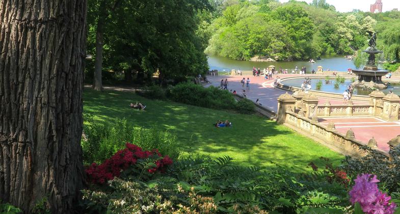
Bethesda Fountain and Central Park Lake beyong. Photo by Denise Liftin.

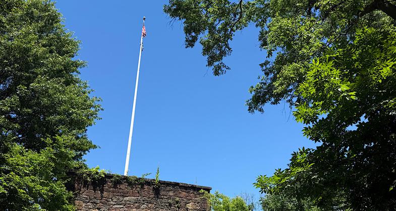
Blockhouse

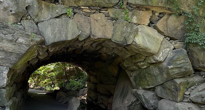
Huddlestone Arch

East Meadow

One of the Meadows

View across the reservoir

Harlem Meer

The El Dorado

Arthur Ross Pinetum

The Rambles
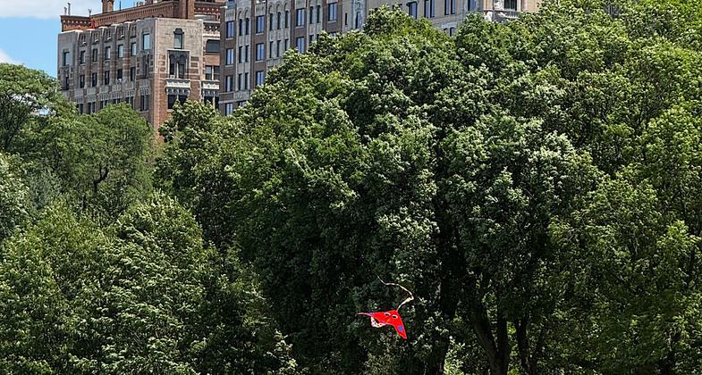
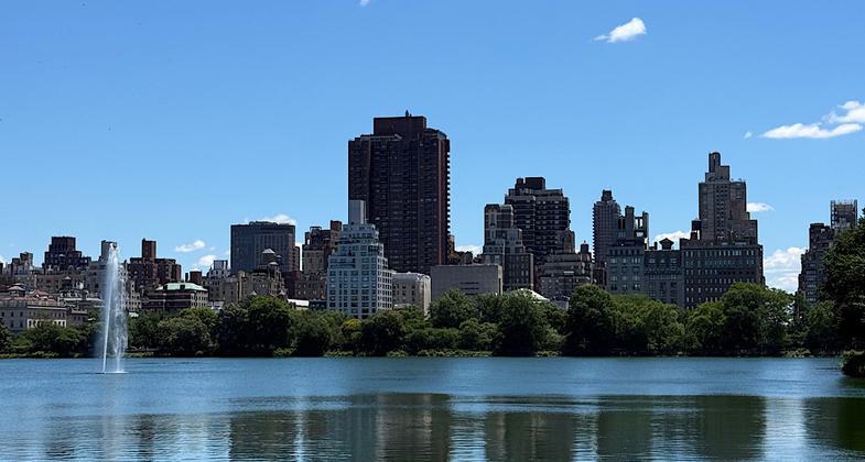
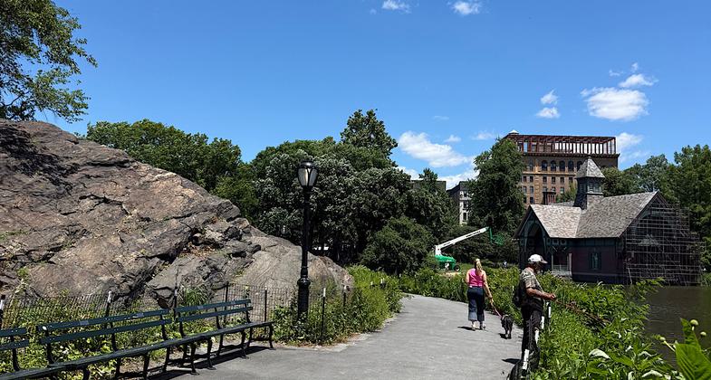
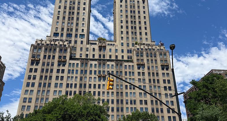
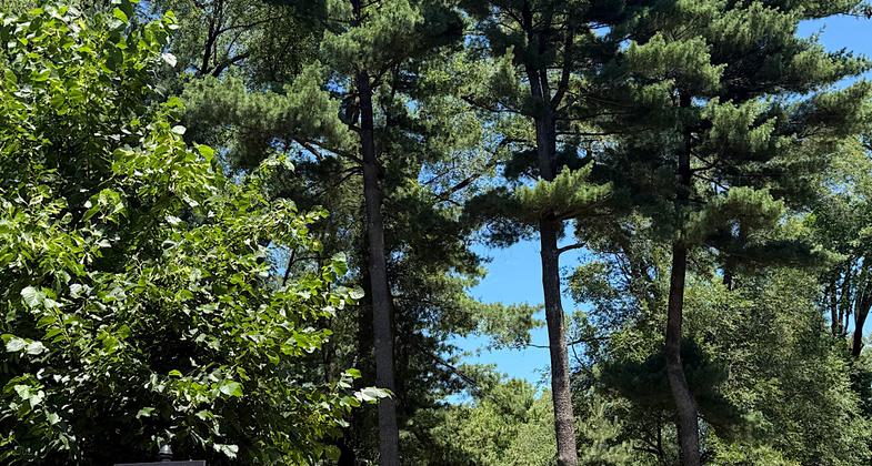
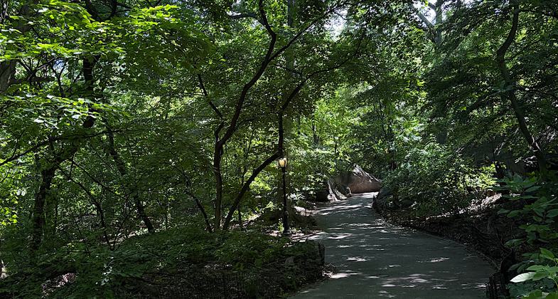
Location: Explores the length of Central Park in downtown Manhattan.
- States: New York
Central Park was built between 1858 and 1873 and designed by Americans first landscape architectects, Frederick Law. Olmsted and Calvert Vaux. The trail has many of the features designed by Olmsted and Vaux which create a natural setting, for city dwellers..
This pioneer project in city park design helped set the tone for many city parks in the nineteenth century and still serves as a model for urban restoration efforts today.
Here is the original trail narrative from the 1979 application for NRT designation:
While you may begin or leave this trail at any convenient point, its official start is the Dairy. Designed by Calvert Vaux and completed in 1870, the Dairy, which is today a museum and park information center, once served milk to city children. Then as now the surrounding area was a popular attraction to children because of its carousel and rock outcrop known as the Kinderberg, or "Children's Mountain," which makes an excellent natural slide.
From the Dairy walk north across the East Drive to the Mall. In contrast to the undulating and naturalistic landscape around it, the Mall is a formal landscape composition. It was designed as a place of congregation, a dignified and elegant promenade. Its southern end is called Literary Walk and is flanked by statues of writers like Robert Burns and Sir Walter Scott who were much in vogue in the nineteenth century. A fine statue of Shakespeare by the artist John Quincy Adams Ward is notable, as is the same artist's sensitive interpretation of an Indian Hunter nearby.
A double row of elms shades the Mall. These elms, protected by a special tree care program, are perhaps the finest remaining stand in North America since Dutch elm disease has leveled so many of the remarkable specimens that once graced village greens and college campuses. Here, yet intact, the Mall elm plantation creates a cathedral-like architecture.
Another pleasant piece of landscape architecture is the Wisteria Pergola overlooking the northeast corner of the Mall behind the Bandshell. The hoary vines which enclasp the rustic framework like massive tentacles date from the Park's beginning and represent one of the earliest plantings of wisteria in this country following its introduction from the Orient in 1860.
An ornately carved set of stairs leads you under 72nd Street to the Terrace; this staircase is one of many examples throughout the Park of the designers' careful separation of different modes of traffic. The Stairs and Terrace were designed by Calvert Vaux and Jacob Wrey Mould and ornamented with a profusion of intertwining vegetation filled with birds, fruits and flowers. This staircase is one of the finest examples of stonecarving in the Park and shows the ingenuity with which these Victorian artists employed the forms of nature in a highly original design of great dignity and strength.
The focal point of the Terrace, and indeed of Central Park, is Bethesda Fountain. Upheld by cherubs emblematic of Temperance, Purity, Health and Peace, the figure atop the fountain depicts the angel who came to the Pool of Bethesda bringing healing powers to the people of Jerusalem. The work is meant to symbolize the great advance in public health which the coming of Croton Aqueduct water to New York City in 1842 represented to its population.
Return to the 72nd Street Drive and walk west to Cherry Hill. When carriages and not cars traversed the Park drives, drivers would pause at Cherry Hill to rest themselves and refresh their horses with water from the fountain. The newly restored fountain is still an excellent vantage point for one of the best views in Central Park, providing a panorama of the lake which includes Bow Bridge, the Hernshead with its charming Ladies' Pavilion, and the Ramble. Many of the trees on Cherry Hill are of specimen quality. There are ginkgos which turn a fine buttery yellow in autumn, several cut-leaf beeches, two magnificent tulip trees and a grove of flowering cherries.
Walk down the north side of Cherry Hill to Bow Bridge and the Lake. Bow Bridge links Cherry Hill to the Ramble while spanning the Lake at its narrowest point. The bridge, which is made of cast-iron, was designed by Calvert Vaux. As you look across Bow Bridge notice how the steep rocky banks and undulating wooded shoreline of the Ramble belie the fact that the Lake is man-made. Using an area of natural drainage, the Park's designers and engineers created a naturalistic body of water. In the winter of 1858 the Lake was opened for skating. Peak attendance in the Park often occurred on wintry nights when throngs of skaters came to the Lake and sleigh riders passed over the snow-packed drives. Boating began on the Lake in 1860 and is still a popular summer pastime. The omnibus or passenger boat that would debark from the Terrace and circle the Lake is part of the Park's past, but the rustic boat landings where passengers were picked up or dropped off can still be seen along the shoreline.
Looking west, notice the Dakota and the skyline of Central Park West. In 1884 the Dakota became the first of many proud apartment buildings that would rise along Central Park West once the Park was built. The richly eclectic facade of the Dakota is an impressive addition to the Park's scenery, as are the splendid twentieth century towers which make this particular stretch of New York City's skyline singularly impressive.
Crossing Bow Bridge, enter the Ramble. A picturesque landscape of thirty acres, the Ramble is filled with meandering paths, bold rock outcrops and intimate scenic effects. For Frederick Law Olmsted the Ramble was "not absolute wildness, but enough to please the poet, artist, and all who love nature." It would be a place where plants would grow and spread as they wished without visible restraint. The romantic character of the place was further enhanced by crowning the rock promontories of this part of the Park with rustic summerhouses and — in one dramatic instance — a castle. The Rustic Arch and Cave were also intended to excite the visitor's imagination.
The cascade emptying into the Lake is one of several that mark the course of the Gill, the slender stream which threads its way through the Ramble. The Ramble is noted for its bird life: 259 species have been observed there.
Leaving the Ramble by Bank Rock Bridge, you can cross the western arm of the Lake. The beautifully carved oak railings of the bridge have unfortunately disappeared, but the willows and their watery reflections create a soft foreground for yet another spectacular city view: the skyscrapers of midtown Manhattan.
Re-enter the Ramble and head north for Vista Rock, Belvedere Castle and Belvedere Lake. The 135-foot high summit of Vista Rock presented an interesting problem to the Park's designers. A highly visible landmark when the Park was still fairly bare, it first supported a wooden tower upon which a large red ball was hoisted as a signal when the Lake was frozen hard enough for skating. This was soon replaced with a miniature Victorian Gothic castle which became the terminus of the view from the Mall and a beckoning landmark to every Ramble visitor. From the terrace of Belvedere Castle one could gaze north across the receiving reservoir which, except for the remnant that today forms Belvedere Lake, was filled in to become the Great Lawn.
Descend the steps leading east from Belvedere Castle, walk around the eastern edge of Belvedere Lake and continue north to the end of the Great Lawn and the Ross Pinetum. Here pines from the forest, mountain slopes, sea cliffs and temple gardens mingle, offering interesting contrasts of color, texture and form. Pine trees were once more prevalent in Central Park than they are today. There was even a Winter Drive banked by evergreens. Look for vestiges of it as you walk north along the West Drive to the Reservoir.
Various species of gulls and ducks dot this huge glassy sheet of water, the source of some 50 million gallons of city water daily. A footpath, much frequented by joggers, makes a circuit of the Reservoir, while a bridle path at the base of the adjoining slopes follows a similar course. Pedestrian paths cross the bridle trail over cast-iron bridges, and three exuberantly ornamental Reservoir bridges, like Bow Bridge, are particularly fine examples of this form of nineteenth century construction technology. The Reservoir is lined with cherry trees along its eastern edge; here too, the embankment is heavily planted with rhododendrons.
Continuing north you will come to the East Meadow, a pleasant grassy expanse which, in contrast to the North Meadow and the Great Lawn, has not been given over to ball fields. Here the Park's designers provided a serene and pastoral scene, different in mood from the animated picturesqueness of the Ramble. Notice the large number of fine old beech trees along the western pathway and a noble elm beside the 97th Street Transverse Road.
Exit the Park at 102nd Street onto Fifth Avenue and walk north two blocks to the Conservatory Garden, which you will enter through the beautiful wrought iron Vanderbilt Gates. Designed by Thomas Price in 1936, this formal garden replaced a large glass conservatory housing seasonal floral displays, several greenhouses and a nursery which stood on this site. The Conservatory Garden is actually composed of three distinct gardens. The main garden includes a broad expanse of lawn, a fountain and a terraced slope which culminates in a wisteria pergola. On either side of the lawn, allées lined with crabapples reinforce the spatial thrust toward the terraced slope and vine-covered pergola. The adjoining north garden provides an elaborate and appropriate setting for the Untermeyer Fountain, a bronze sculptural composition set in an oval pool. The south garden is more informally planted, and its centerpiece is another fountain sculpture dedicated to the children's author Frances Hodgson Burnett.
Exit from the north gate of the Conservatory Garden and follow the southern shore of the Harlem Meer past Lasker Rink, walking west along the banks of the Loch. Not subject to the intense recreational use prevailing in the southern section of the Park, the northern end maintains with minimal intrusion an identity and life of its own. Rock outcrops project dramatically. Thickets of forest-like growth are more common than well-defined tree or shrub plantings. Instead of gradual changes in ground level, the land often drops off abruptly, then rises sharply. Far-reaching views appear more unexpectedly and are often more startling. Bird life flourishes.
While it is true that this part of the Park was left to a large degree in the rugged wild state of nature that existed here before 1858, it is also true that its designers lavished upon the area the same amount of picturesque details as they did in the Ramble. Thus, the Loch was created out of a small stream called Montayne's Rivulet which was made to spill over man-made rock ledges in three beautiful small waterfalls. The Loch is fed by the pool, and it in turn receives water from the cascade, yet another picturesque contrivance thought up by Olmsted and Vaux. Much of this artful water display was created by the positioning of huge boulders at a time when there were no heavy duty machines to hoist them in place, only men and horses. Equally impressive is the Huddlestone Arch, a large tunnel of rough-hewn boulders held together without the use of mortar, supporting each other by their sheer weight.
Cross the bridge between the Pool and the Loch, follow the path that leads up to the top of the Great Hill, circle halfway around it and descend the path which leads northeast to the Blockhouse. The Blockhouse sits atop one of the Park's many outcrops of Manhattan schist. Like the sites of Fort Fish and Fort Clinton to the east, it commands a fine view of the Harlem plain and was thus an important lookout point in the American Revolution when the British held New York City, and later in the War of 1812–14 when local militia, fearing British invasion once again, hastily constructed the present stone fortification.
From the Blockhouse you may walk either east or west to exit the Park, where you will find convenient public transportation on Fifth Avenue and Central Park West.
Accessibility Information
No text provided.
Reviews

Patricia Ellis
Great way to explore Central Park
Walked on June 20, 2026. This is not a marked trail. There are no signs about this NRT, and the folks at the Visitor Centers don’t know about it. Nevertheless, this is a lovely way to explore massive Central Park. Follow the original narrative found in the NRT description above. Print it out or screenshot it, and then follow the directions from site to site throughout the Park. I found this an educational and enjoyable experience. I learned a ton, and the Park is full of benches and food vendors and street musicians and even public bathrooms here and there, so you can take your time and enjoy the day. Note that the mileage stated here is incorrect. You will likely walk between 6 and 8 miles depending on where you enter the Park to get to the Dairy, and also if you decide to do side quests within the Park as you wander along. Highly recommend exploring Central Park using this NRT description.
Allowed Uses:
Bicycling Hiking/WalkingPublic Contact
NYC Dept. of Parks & RecreationThe Arsenal
Central Park, NY 10021
Contact the trail manager for current maps and visiting details.
More Details
- Elevation (low): --
- Elevation (high): --
- Elevation (cumulative): --
- Part of a Trail System? No
- Surface (primary): --
- Surfaces (additional): --
- Tread Width (average): 0"
- Tread Width (minimum): --
- Running length (minimum): --
- Tread Grade (average, percent): --
- Tread Grade (maximum):
- Running length (maximum): --
- Cross-slope (average, percent): --
- Cross-slope (maximum): --
- Running length (maximum): --
- Certified as an NRT
Nov 18, 1979